


The ultimate boating simulator with the world's most complex archipelago
Stormwind Simulator is a unique training tool for navigation and high-speed boat driving. Among it's strengths are realism, a rich feature set, cost efficiency and portability. With the simulator you'll be able to train without being dependant on boat and resources, or weather and season - easily, to an affordable price and without special equipmet. The simulator is popular among authorities and the navy, as well as organisations and households.
The Stormwind boating simulator brings the conditions of the archipelago to you. It shows what it looks like "out there" and allows you to manouver boats. You will find thousands of islands, obstacles and navigational objects at their expected locations and can polish the skills of yourself or others without rush and without having to take into account fuel and resource costs, weather conditions or family and kids. The simulator is a portable Windows application that supports up to 4 screens and a wide range of Windows-compatible controller equipment like steering wheels and throttle handles. Multiplayer and multi-participant cockpit simulation versions are under development. It is delivered on a USB stick.
Time and Space
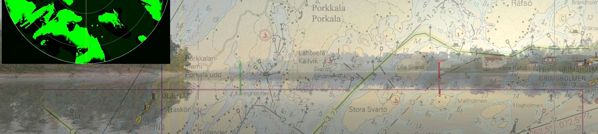
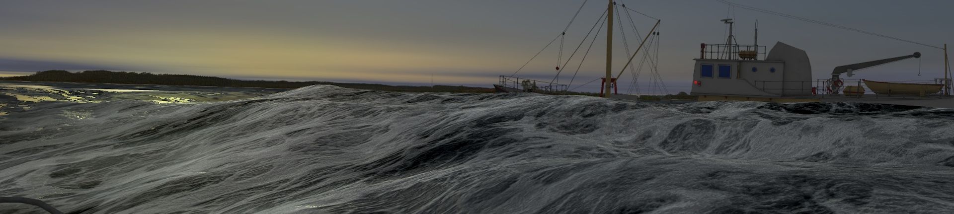
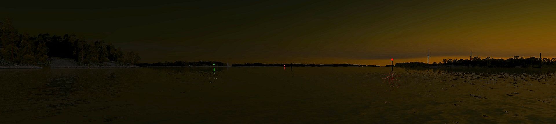
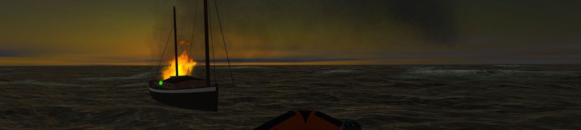
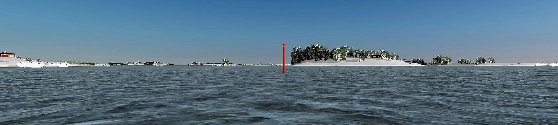
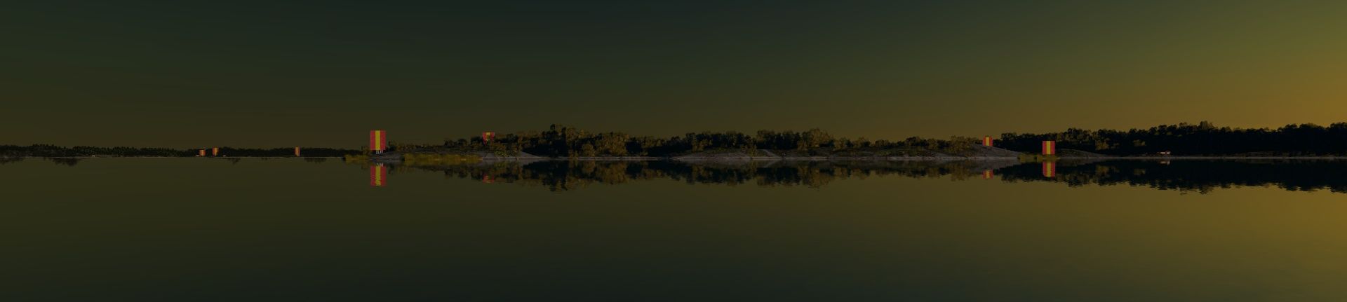
The simulator manages time and space accurately, and reflects the real world including it's geography. The simulator supports a large area of ca 30000 square kilometers, matching the Finnish A, B, C and D full seachart series (all of the south coast, the Åland islands and the Archipelago Sea). The area is to become larger soon. The weather conditions may be set from calm to storm, and from melting sunshine to heavy rain with thunder and fog. Any clock time is supported, as well as dates in future or past. The simulator can grab the weather data from the Finnish Meteorological Institute's weather service, based on your currently simulated position. It mounts it's visual representation by using ENC- and geodata maintained by the states.
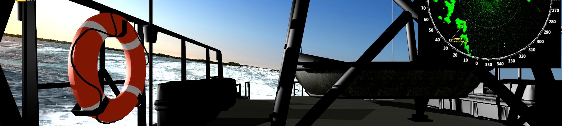
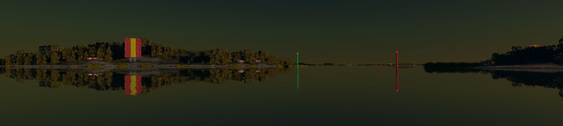
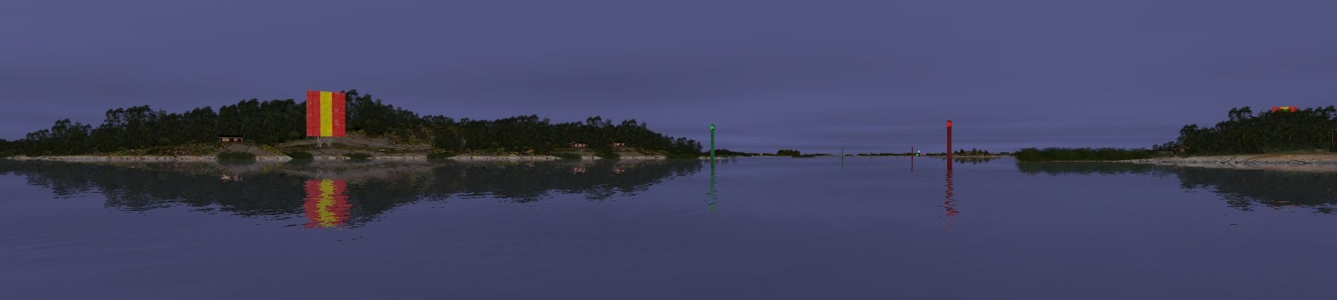
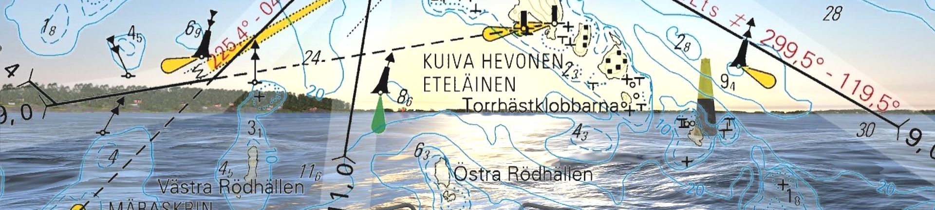
Highly realistic navigation
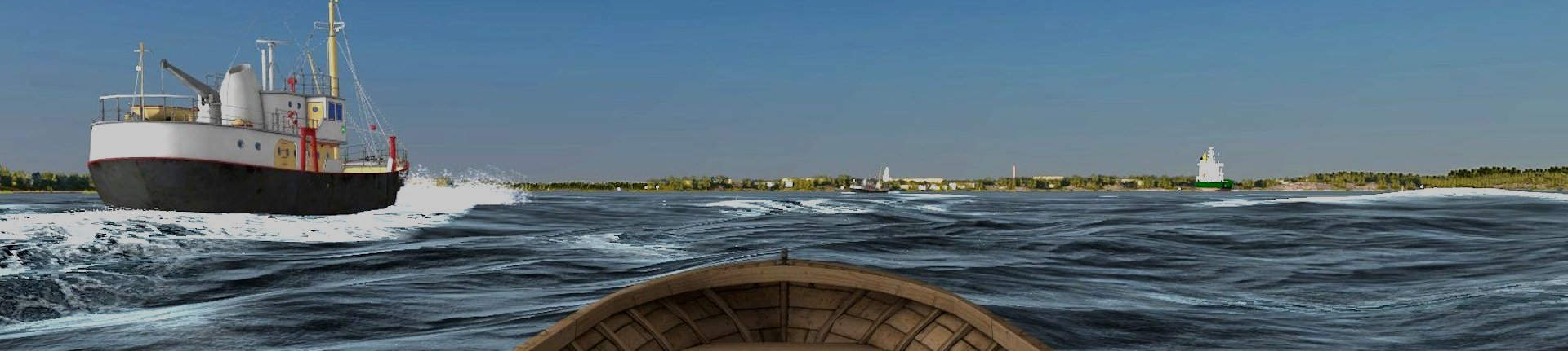
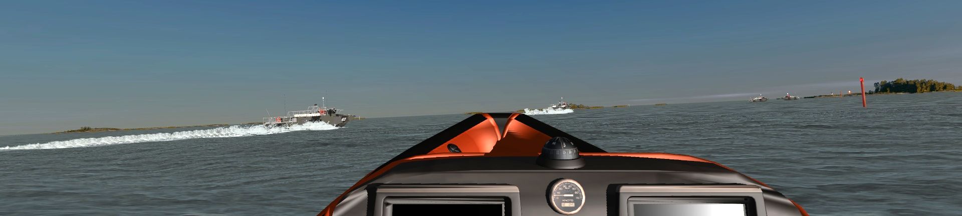
The simulator submits navigation in the world's most dense, challenging and dangerous archipelago in a very realistic manner to the user. Navigational aid/objects will appear shown at correct locations, light beacons will signal as in the real world. The simulator is suitable for use by authorities, education or anyone who wishes to improve the own navigational skill set. The support for night-time navigation and navigation in extreme conditions make the simulator unique. The simulator is especially fit for high-speed navigation training with fast crafts below 24 meters.
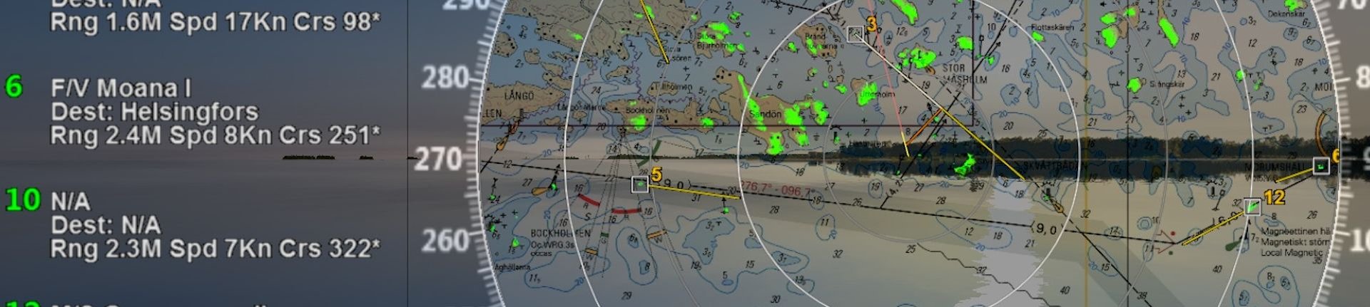
Radar simulator
Stormwind Simulator encompasses a radar simulator that presents echoes using 3D geometry. It supports among others radar shadow, sea clutter, head/north up modes, VRM/EBL, ARPA/AIS and holds a readyness for waypoints and approach alarms.
Water jets
Stormwind has an excellent waterjet simulation (Combat Boat 90). It's beneficial to connect the engine rev and waterjet deflector management to external controller hardware and axis. With the waterjets you will be able to move the boat sideways, or keep the bow against a buoy while rotating the stern around.
Compasses
The simulator has a highly realistic magnetic compass, in addition to fluxgate, gyro- and GPS-compasses. The magnetic compass is a "mathematically rigged" compass card that moves with the hulls acceleration forces. It takes mass and gyro effects, declination and deviation into account. The compass meets IMO:s stipulations for magnetic compass card lag by ROT.
Development
The simulator is submit to ongoing development. New geographical areas get added, technical details polished and entirely new features invoked. It is set to additionally being a sailing simulator at the consumer end, while it is extended with additional features aimed at professionals. by using targeted version management.
More information
Please send us your inquiry using the email address below.